-40%
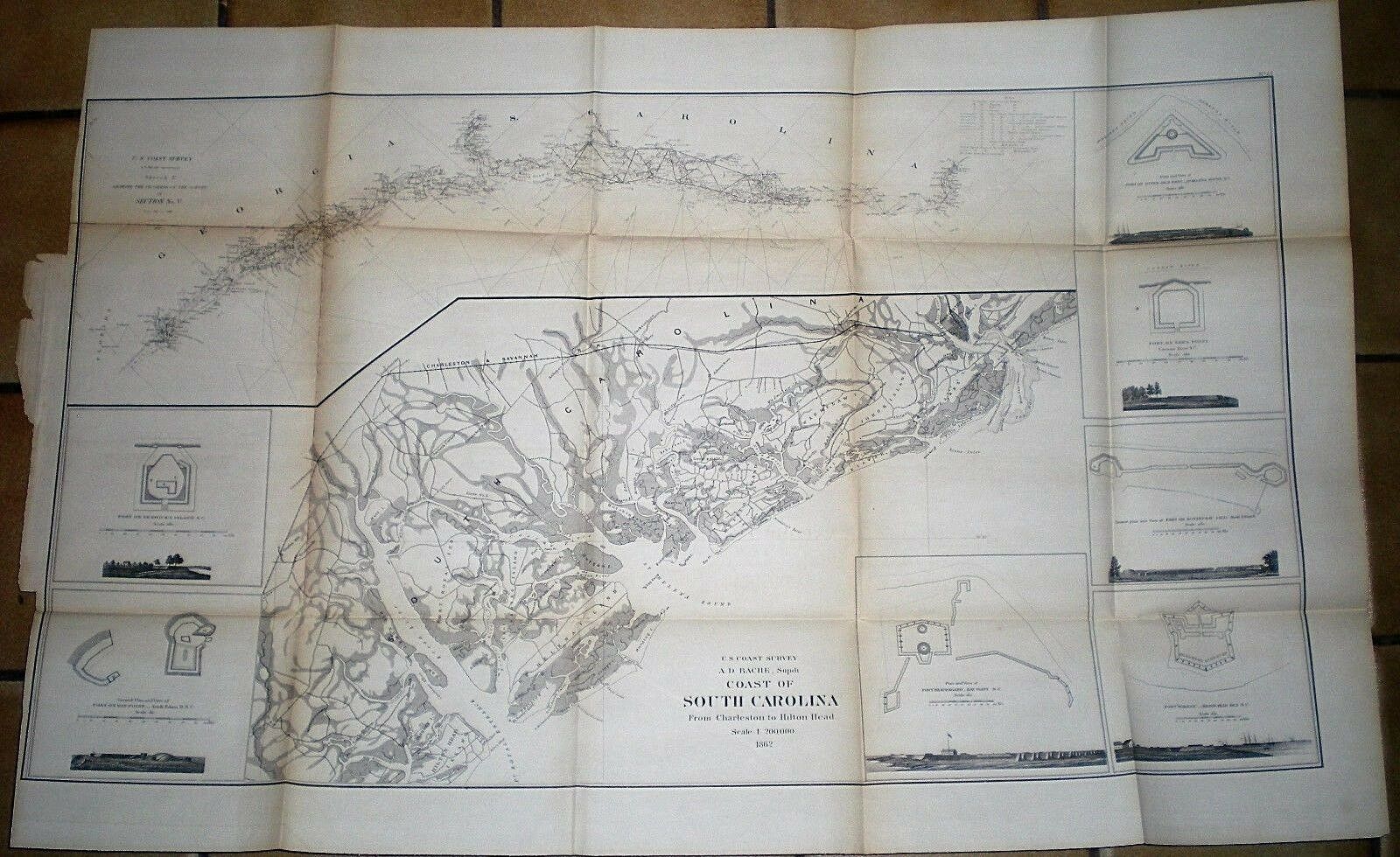
1862 CIVIL WAR MAP ~ CHARLESTON TO HILTON HEAD, S.C. ~ VIGNETTES OF 7 FORTS
$ 60.72
- Description
- Size Guide
Description
Originaland rare U.S. Coast Survey Map showing the Coast of South Carolina from Charleston to Hilton Head, 1862. A.D. Bache, Superintendent of the Survey. This large map measures approx. 23-1/2 x 37 inches. Some browning along some fold lines; archival tape applied to reverse side to "mend" and reinforce some of the fold lines and fold joints. Very good condition. There are engraved vignettes of seven (7) forts along the coast line (see scans). The triangulation map shows from the Florida border up to Georgetown, S.C. (Winyah Bay).
